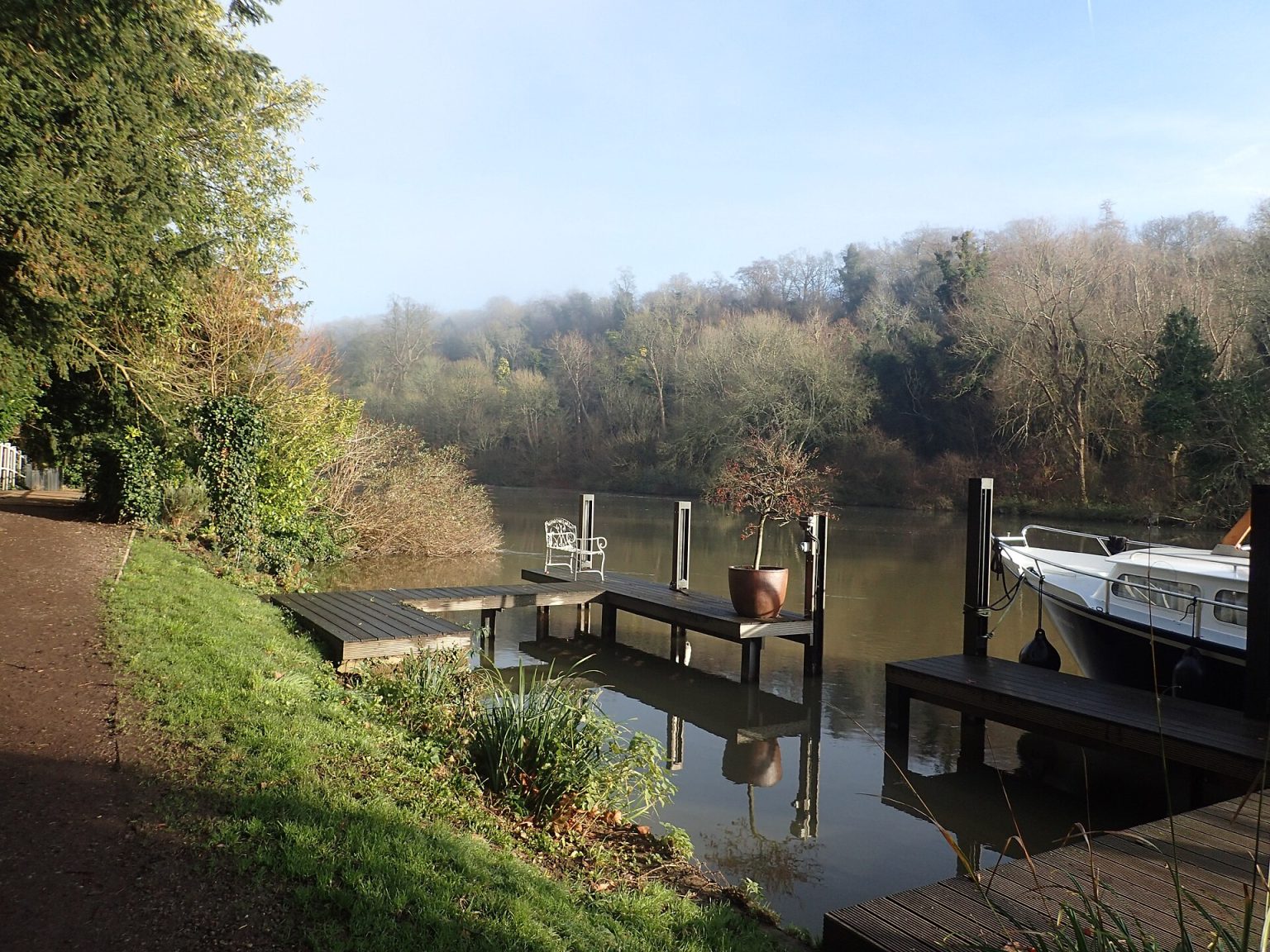
Maidenhead is a green town if you know where to look. The Thames runs along its eastern edge with a path beside it all the way to Windsor and Cookham, the Victorian benefactors left it parks with fine old trees, and on the north-west side the commons and woods of Maidenhead Thicket and Pinkneys Green begin where the houses stop. In a single afternoon you can go from a play park to an island in the river to a Bronze Age burial ground on a marsh.
Below are the council’s main parks, the woods and commons, and the long riverside routes, with facilities, parking and dog rules as each managing body describes them. We checked them in November 2026. The council lists more than 30 parks and open spaces in Maidenhead, and barbecues and metal detectors are not permitted in any of them.
Where should I walk in Maidenhead?
Some quick picks to get you started.
- For a short riverside stroll: Boulter’s Lock and Ray Mill Island, then along Ray Mead Road to Riverside Gardens.
- For a long walk: the Thames Path upstream to Cookham, past the Cliveden woods.
- For history on foot: Guards Club Park, with views of Brunel’s Sounding Arch and the 1777 road bridge.
- For woodland and wildflowers: Maidenhead Thicket off the Henley Road.
- For a flat path you can cycle too: the Jubilee River from Taplow.
Which riverside parks are there in Maidenhead?
Ray Mill Island
Ray Mill Island is a 1.6-hectare island park beside Boulter’s Lock. You reach it from Ray Mead Road over the road bridge at the lock, past the riverside pub, and then over a footbridge. It has an aviary and a guinea pig enclosure, a small play area for children aged three to eight, picnic tables, toilets, cycle racks and a privately run cafe.
The island takes its name from the Ray family, who ran a flour mill there, and the borough council bought it in 1950 from the Conservators of the River Thames. At its northern end, Boulter’s Weir is one of 50 weirs left on the Thames, and a salmon ladder there opened on 19 May 2000. From September to April the council can close the island when river levels make access unsafe, deciding each day.
Riverside Gardens
Riverside Gardens is a 1.7-hectare park on Ray Mead Road, a little downstream of the lock. It has a play area for children aged three to 12, a privately run cafe with crazy golf, toilets at the back of the cafe and paid parking. Our guide to the Thames at Maidenhead covers the whole riverside, from the lock to the bridges.
Guards Club Park and Island
Guards Club Park, reached from Oldacres off Oldfield Road, is a 1.1-hectare conservation area with views of Brunel’s Sounding Arch and Maidenhead Bridge. The Guards Club was once a place of recreation for officers from the Windsor and Pirbright depots; plaques record that the park replaced it for the Silver Jubilee in 1977, and the gates on Guards Club Road came from Maidenhead’s first public library, opened in 1904.
A footbridge leads to the island, which is closed every year from December to June, though the park itself stays open. There is a small car park, and the Round Berkshire Cycle Route passes through. Our Maidenhead bridges page explains what you are looking at across the water.
Which are the best town parks?
Kidwells Park
Kidwells Park covers 3 hectares between the town centre and the houses to the north, with entrances on Cookham Road, St Lukes Road and Marlow Road. From the centre, use the pedestrian crossing on Bad Godesberg Way by the Premier Inn or the subway from the West Street car park. It has a play area for ages three to eight, the Matrix skate park, courts for tennis, netball and football, a First World War memorial garden and lit paths, and it is open at all times.
The park was given to the town on 23 July 1890 by J. D. M. Pearce, five times Mayor of Maidenhead. It was once the home of the Thames Valley Rugby Club, which became Maidenhead Rugby Club when it moved to Braywick in the 1960s.
Grenfell Park
Grenfell Park on Grenfell Road, close to the town centre and the station, was given to the town in 1897 by Lord Desborough, William Grenfell, to mark Queen Victoria’s Diamond Jubilee. Look up at the trees: some unusual ones were grown from seeds he collected on his travels around the world. Today it has two play areas for children up to 13, a court for basketball and netball, an outdoor gym, a cafe with toilets and a small car park.
Desborough Park
Desborough Park (4.87 hectares) is reached from The Croft, Fane Way or Desborough Crescent. It has a play area for ages three to 12, a skate park, an outdoor gym, two multi-use games areas, two tennis courts, football pitches with a pavilion and the Larchfield Community Centre. A small public car park is at The Croft, and in the summer holidays residents run a snack shop from the pavilion.
Oaken Grove
Oaken Grove is an 8-hectare park in north-west Maidenhead, with entrances on Courthouse Road, Ashcroft Road and Oaken Grove. The land was part of the Pinkneys Green Farm Estate; the borough bought it in 1935 and laid it out in 1938 and 1939 with a pavilion, tennis courts and a bowling green. It is thought to be named after a grove of oaks on the old farm. Today there is a cafe open seven days a week, a play area for ages three to 16, a fruit maze, football pitches and a car park.
Ockwells Park, Cox Green
Ockwells Park on Ockwells Road, Cox Green, is the biggest of the town parks at 18.1 hectares, with a play area for ages three to 16, toilets, an outdoor gym, a cafe, a car park and pitches for softball and baseball. Part of it once belonged to the Ockwells Manor estate, and the 15th-century manor house, built with oak from Windsor Forest, lies to the west. A lap of the park is about 3,200 steps. See our Cox Green page.
Braywick Park
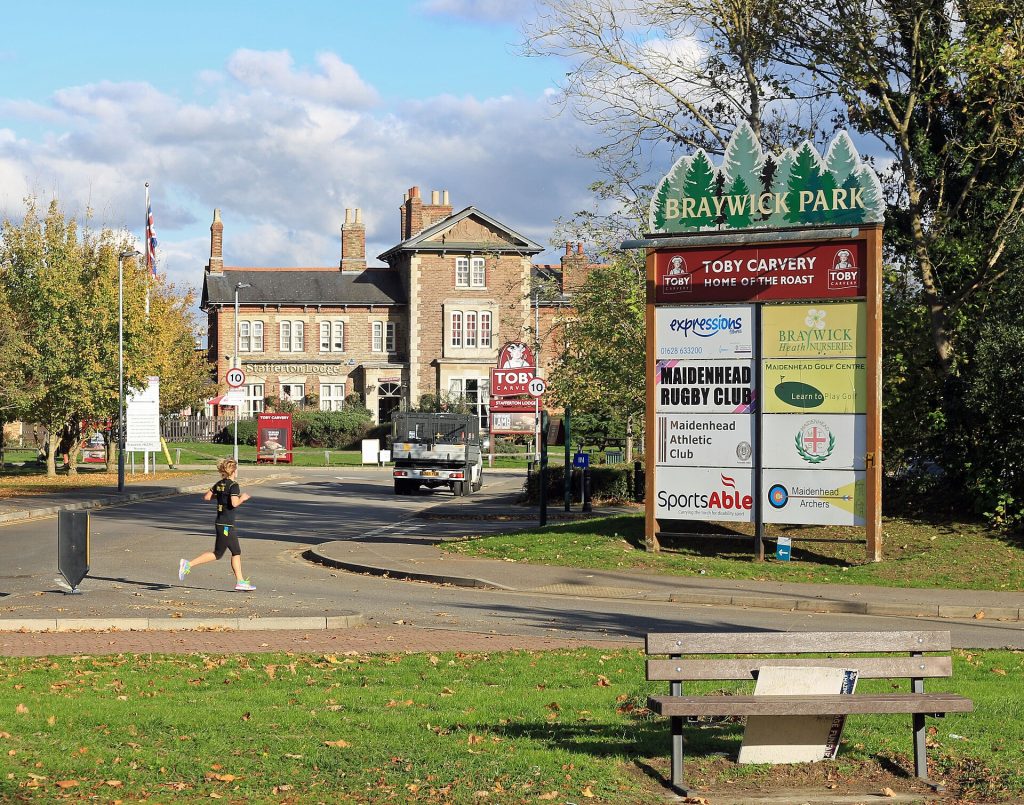
Braywick Park covers 40 hectares on the edge of town, including about 22 hectares of sports grounds for rugby, football, archery and athletics and a 15-hectare Local Nature Reserve. It has a play area for ages nine to 14 and is on the Green Way walking route. Dogs are welcome but must be on a lead on the marked sports pitches. Our Braywick Nature Centre guide covers the reserve.
Where are the woods and commons?
Maidenhead Thicket
Maidenhead Thicket is reached from the Henley Road (A4130) and is managed by the Royal Borough and the National Trust. The council’s 6.1 hectares are the site of a prehistoric Celtic farm enclosure, and the Thicket appears in documents going back to the 17th century. In spring there is a fine show of wildflowers, and the ponds and marsh support rare plants, including water violet, flowering rush and greater bladderwort.
The council lists no facilities, so come prepared. Next door, Pinkneys Green is surrounded by common land, and our famous people page tells the story of the highwayman Claude Duval, who robbed travellers on the Thicket.
Cock Marsh, Cookham
Cock Marsh lies beside the Thames just upstream of Cookham, below a steep chalk slope. More than 150 acres (61 hectares) of marsh and hillside were bought by a village committee and given to the National Trust in 1937. Part of it is a Site of Special Scientific Interest, notified in 1983, for its marshy grassland and ponds, where plants such as marsh arrowgrass, water violet and the rare brown galingale grow.
The marsh also has a Bronze Age barrow cemetery of four burial mounds, excavated between 1874 and 1877 and later reused by the Anglo-Saxons; only the largest mound is easy to see today. Horses and cattle graze the land, so keep dogs under close control. Check the National Trust before you go for parking and dog rules. Our Cookham guide has routes from the village.
What are the best long walks from Maidenhead?
The Thames Path
The Thames Path National Trail runs 185 miles (298 km) from the source of the Thames in the Cotswolds to the Thames Barrier at Woolwich. Its Marlow to Windsor section is 14.3 miles (22.3 km): it passes the wooded slopes of Winter Hill, goes through Cock Marsh and Cookham Commons, runs beside the Cliveden estate and comes down through Maidenhead to Windsor and its castle.
National Trails are waymarked with an acorn symbol, the path is mostly flat, and most stiles have been replaced with gates, though some structures may still be barriers for people with limited mobility. Flooding can affect the whole trail, so check before a winter walk and never walk through floodwater. Diversions and closures are signposted.
The Jubilee River
The Jubilee River is a man-made flood relief channel, 11.6 km long, built by the Environment Agency and opened in 2002. Weir gates at Taplow split water from the Thames into it, and it rejoins the Thames at Datchet. Footpaths run beside most of its length for walking, running, cycling and horse riding, and parts close for safety when the channel is in use. No swimming is permitted anywhere along it.
It was planted as a new river, with reed beds, wet woodland and about 250,000 trees, and red kites, lapwing and green woodpeckers are among the birds seen along it. Walk Wheel Cycle Trust’s Jubilee River and Eton Dorney circuit is 12.7 miles (20.4 km), 78 per cent traffic-free, on National Cycle Network routes 4 and 61, past Dorney Lake and the Dorney Wetlands. You can start from Maidenhead station.
The Green Way and the York Stream
The Green Way is the footpath along the York Stream, the waterway that runs south through the middle of Maidenhead from the Thames near Cliveden, past the historic Chapel Arches. It is part of the Maidenhead Waterways, whose first restored section, with a new weir and fish pass, was finished in March 2020 and opened by Theresa May on 14 March 2020. The Green Way continues south through Braywick Park, so you can follow it from the town centre to the nature reserve.
Three walks to try
- Boulter’s Lock to Cookham: follow the Thames Path upstream from the lock with the Cliveden woods across the water, then cross Cookham Moor into the village for lunch. Come back by the 37 or 37M bus.
- The bridges loop: from the town centre, walk down to Maidenhead Bridge, along the river to the Sounding Arch to try its echo, and back through Guards Club Park.
- Thicket and commons: start at Maidenhead Thicket on the Henley Road and wander the paths towards Pinkneys Green. Good in spring, when the wildflowers are out.
For a pub at the end, our Sunday lunch guide picks out village pubs near these routes.
Can I take my dog?
Yes, to most places, with care. Braywick Park welcomes dogs, on a lead on the marked sports pitches, and has waste bins throughout. The other council park pages we read give no dog rules, so follow the signs at each park. On Cock Marsh and the other commons, livestock graze, so keep your dog close.
Where can I park?
Ockwells Park, Oaken Grove, Grenfell Park and Guards Club Park have car parks, Desborough Park has a small one at The Croft, and Riverside Gardens has paid parking. Braywick Park has a large car park. See Maidenhead parking information for the council’s car parks and charges.
Frequently asked questions
What is the biggest park in Maidenhead?
Braywick Park, at 40 hectares including its nature reserve. Of the town parks, Ockwells Park in Cox Green is the largest at 18.1 hectares.
Which parks suit small children?
Ray Mill Island and Kidwells Park have play areas for ages three to eight; Riverside Gardens and Desborough Park for three to 12; Ockwells Park and Oaken Grove for three to 16. Our family days out guide has more ideas.
Can I walk from Maidenhead to Windsor?
Yes. The Thames Path continues downstream from Maidenhead past Bray to Windsor, and it is mostly flat. Check flood warnings in winter.
Can I swim in the Jubilee River?
No. The Environment Agency does not permit swimming anywhere along the Jubilee flood relief channel.
Photographs
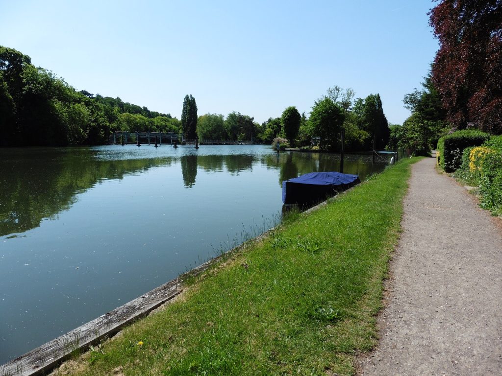
The Thames Path National Trail near Boulter's LockDave Kelly, CC BY-SA 2.0 (Wikimedia Commons: The Thames Path National Trail near Boulter's Lock) 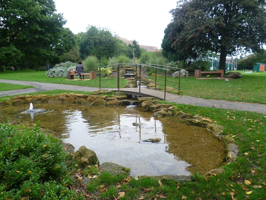
Kidwells Park, MaidenheadMarathon, CC BY-SA 2.0 (Wikimedia Commons: Kidwells Park, Maidenhead)