Boyn Hill is a district on the west side of Maidenhead, about 1 km from the station in a straight line. Its skyline belongs to one building: the tower and stone spire of All Saints Church, which has watched over the neighbourhood since the 1850s. Around it you will find three church schools and a couple of useful parks.
You will see the name spelt two ways: the ward and the main road use “Boyn Hill”, while the infant school and the church’s web address use “Boyne Hill”.
Where is Boyn Hill?
Boyn Hill lies west of the town centre, between the A4 and the railway. It is also a ward of the Royal Borough of Windsor and Maidenhead, in the unparished part of the borough, so there is no parish council.
What is Boyn Hill like to live in?
It feels like a settled neighbourhood rather than a village. The church and its old school buildings give it a recognisable centre, and the station is about 1 km from the church in a straight line.
An infant and nursery school, a junior school and a secondary school for ages 11 to 18 are all within the ward. Two council parks are within easy reach. For the wider picture, from doctors to bins, see our guide to living in Maidenhead.
What is the history of Boyn Hill?
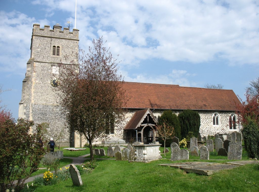
All Saints Church
All Saints was designed by George Edmund Street and built in 1854 to 1857 as a Tractarian church, and it keeps that Anglo-Catholic tradition today. Its first vicar, William Gresley, served from 1857 until his death in 1876.
Historic England lists the church at Grade I, the highest grade. The listing describes red brick banded with blue brick, Bath stone dressings, an octagonal stone broach spire on a brick tower, and a chancel lined with black and white brick, coloured tiles and polished alabaster. Street’s son, A. E. Street, added the two westernmost bays of the nave and a vestry in 1907 to 1911.
Street also built a vicarage, a school and schoolmaster’s house, almshouses and a lodge as one group, and several of these are listed in their own right, including the former vicarage and the former All Saints School at Grade II*. Across Boyn Hill Avenue, a house built in the same years for Emily and Maria Hulme is listed at Grade II.
You can find the church on Church Close, Boyn Hill Road, SL6 4HE. Service times are on the All Saints website.
A station of its own
Boyn Hill once had its own railway station. The Wycombe Railway opened a stop on Castle Hill on 1 August 1854, renamed it Maidenhead Boyne Hill in 1866, and closed it on 1 November 1871, when the new Maidenhead Junction station opened to serve the whole town. A gazetteer of 1870 to 1872 described Boyne Hill as a chapelry in Bray parish, with 1,071 people, a church built in 1857 and national schools.
Courthouse Road takes its name from an 18th-century court house that stood where Clara Court is now, according to the council. For the bigger story of how Maidenhead grew, read our history of Maidenhead.
Is Boyn Hill a conservation area?
Part of it is. The council lists “All Saints, Boyn Hill, Maidenhead” among the borough’s conservation areas and publishes a boundary map on its conservation areas page.
Which schools are in Boyn Hill?
All three are Church of England schools, taking children from nursery age to 18.
- Boyne Hill CofE Infant and Nursery School, Rutland Road, SL6 4HZ: ages 3 to 7. School website.
- All Saints Church of England Junior School, Westborough Road, SL6 4AR: ages 7 to 11, an academy in the Oxford Diocesan Schools Trust. School website.
- Altwood Church of England School, Altwood Road, SL6 4PU: ages 11 to 18, an academy in the Agape Multi Academy Trust. School website.
For other schools across the town, browse our schools directory.
Where are the parks and green spaces near Boyn Hill?
Boyn Grove, also called Punt Hill, is on Courthouse Road, about 600 metres west of the church in a straight line. It covers 2.8 hectares, with a play area, a small car park and a picnic spot, and the council reckons a lap of the edge is about 950 steps.
Check the council’s Boyn Grove page for play-area works before you visit (checked November 2026).
Grenfell Park, on Grenfell Road, is about 800 metres east of the church in a straight line. Lord Desborough, William Grenfell, gave it to the town in 1897 for Queen Victoria’s Diamond Jubilee, and some of its unusual trees grew from seeds he collected on his travels. It has two play areas for children up to 13, an outdoor gym, a court for basketball and netball, a cafe and toilets (checked November 2026).
For longer walks by the Thames and on the commons, see our parks and walks guide.
How do I get around from Boyn Hill?
From Maidenhead station, Great Western Railway and Elizabeth line trains run towards London; our train information page has the details.
Carousel Buses route 3 runs from Frascati Way in the town centre via the railway station, Boyn Hill and St Mark’s Hospital to Altwood and Farmers Way. Carousel’s route 3 page, checked November 2026, shows a bus roughly hourly. See our travel information guide for more.
Frequently asked questions
Is it Boyn Hill or Boyne Hill?
Both are in use. The ward and roads use “Boyn Hill”; the infant school and the church’s web address use “Boyne Hill”.
How far is Boyn Hill from Maidenhead station?
About 1 km in a straight line from All Saints Church, a little more on foot. Carousel route 3 also links the area with the station.
Who designed All Saints Church?
George Edmund Street, between 1854 and 1857. It is listed at Grade I.
Is Boyn Hill in a conservation area?
The area around All Saints Church is; the council’s map shows the boundary.
Which parks are closest?
Boyn Grove on Courthouse Road and Grenfell Park on Grenfell Road are both within about 800 metres of the church in a straight line.